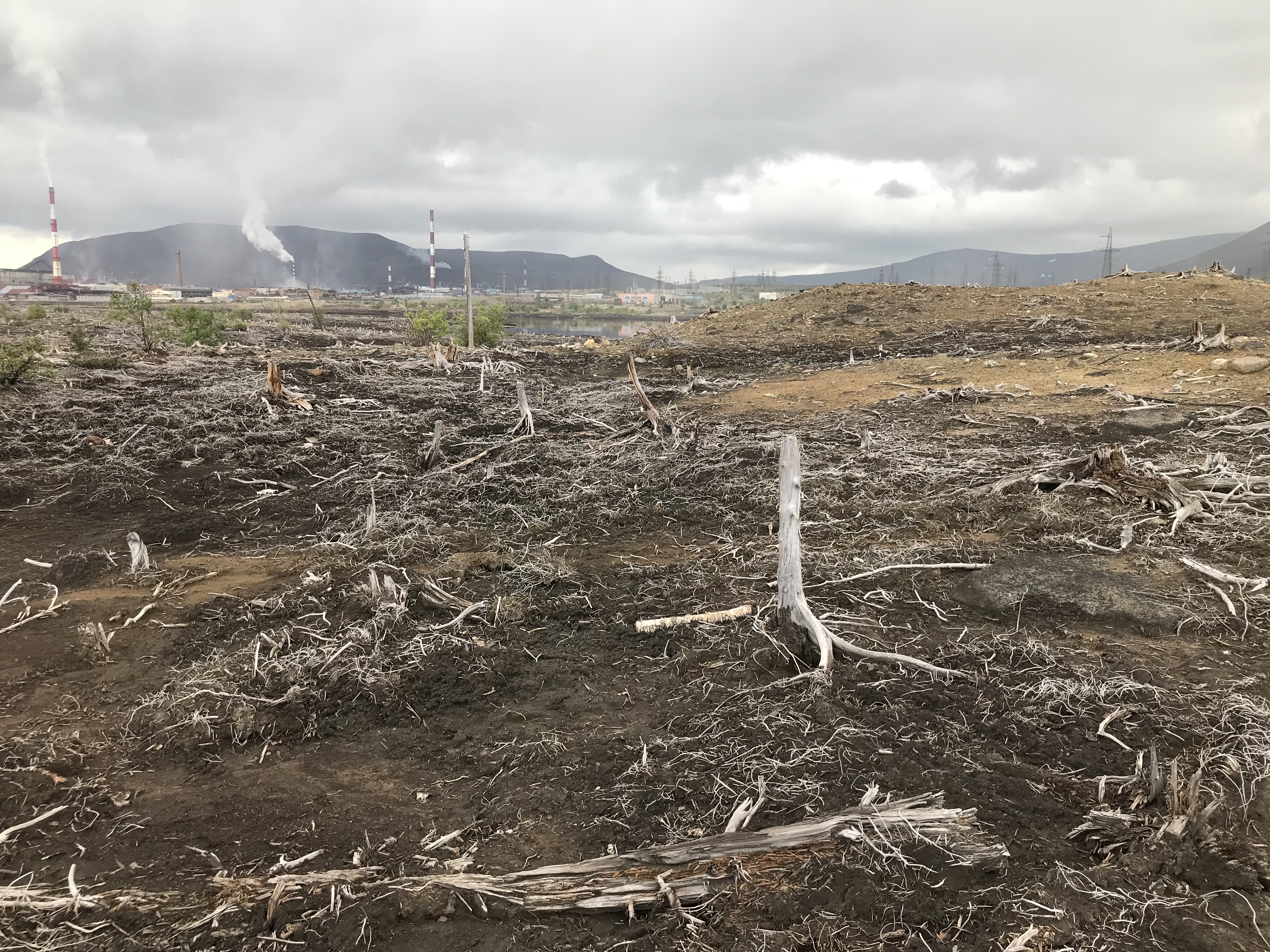
SUN Lab scientists have created maps of distribution of concentrations of heavy metals nickel and copper in the upper soil horizon. This was made possible through data obtained by unmanned aerial vehicles. The essence of the method is to search for statistically significant relationships between point data on the concentrations of hazardous elements in the upper horizon and the parameters of the relief and soils. The approach has been successful in a technogenic wasteland area on the Kola Peninsula, and as expected, in the future, the technology will help scientists more quickly predict soil pollution in vast and remote areas. The results of the study, supported by a grant from the Russian Science Foundation, were published in the journal Land Degradation & Development.
The surroundings of non-ferrous metallurgy plants are often heavily polluted due to long-term emissions of gaseous and solid substances into the atmosphere, which are formed during the processing of metal ores. Sometimes (especially in the north) zones of “technogenic wastelands” are formed around such objects, within which there is practically no vegetation cover. The same thing happened with the territories in the vicinity of the city of Monchegorsk, where a copper-nickel plant has been operating for more than 80 years. Emissions of sulfur compounds and heavy metals can cause health problems in humans, causing cancer and respiratory diseases, as well as degrading the habitats of animals and plants.
The leading industry of the northern region is the extraction and processing of various minerals, which, unfortunately, is often associated with a negative impact on the northern nature. And, although it will not be possible to stop production, with the help of modern technologies it is possible and necessary to create new methods for assessing the content of heavy metals in areas adjacent to industrial zones in order to reasonably take measures for their reclamation, says Yuri Dvornikov, junior researcher at the scientific center Smart Urban Nature of RUDN University.
Scientists from RUDN University (Moscow), in collaboration with colleagues from the Kola Scientific Center of the Russian Academy of Sciences (Apatity), tested a method for analyzing the spatial distribution of heavy metals concentrations in soils. Since sampling at many points is difficult, one can try to find dependencies of heavy metals concentrations on other parameters, which are much easier to obtain, for example, using unmanned aerial vehicles (UAVs). Such parameters can be, for example, soil types and relief features. In particular, at high concentrations of heavy metals in the soil, there is a high probability that they will be washed out from the top areas and accumulate in the lowlands.
The authors of the study obtained point measurements of HMs in soils using a portable X-ray fluorescence analyzer. A detailed image (orthophotomap) and a digital elevation model were obtained on the basis of stereophotogrammetric processing of UAV data. Then, quantitative nonlinear relationships were established between heavy metals concentrations in the upper soil horizon and a remotely obtained map of soil types and derived relief parameters. These relationships were used to “spread” HM concentration values over the entire territory of the key area. For this, machine learning and geostatistical technologies were used. The result is maps of the distribution of copper and nickel concentrations in the wasteland.
UAV data can become an important source of information in digital soil mapping, as well as help to reduce the time and cost of labor-intensive field research. We are confident that the methodology we have worked out will allow us to accurately assess the levels of pollution in the territory of the technogenic wasteland and identify areas that are most in need of artificial restoration of the vegetation cover, said Marina Slukovskaya, co-author of the study and a senior researcher at the Kola Science Center of the Russian Academy of Science.

